hsd_skycal
Note
Parameters set to None will use intelligent defaults from the pipeline context.
Pass explicit values to override context defaults.
- hsd_skycal(calmode=None, fraction=None, noff=None, width=None, elongated=None, parallel=None, infiles=None, field=None, spw=None, scan=None)[source]
Generate sky (OFF-source) calibration tables for single-dish data.
Produces a caltable storing the reference (OFF-source) spectra that are subtracted from on-source spectra to remove non-source contributions (atmosphere + receiver noise).
The WebLog shows integrated OFF spectra per spw and per source for each MS. The y-axis represents the direct correlator output dominated by atmospheric and receiver signals. Different colors indicate different antennas; magenta lines show the atmospheric transmission curves. Time-averaged OFF spectra plots are also shown to assess time variability. Additional diagnostic plots include amplitude vs. time for OFF_SOURCE data and elevation difference between ON_SOURCE and OFF_SOURCE vs. time.
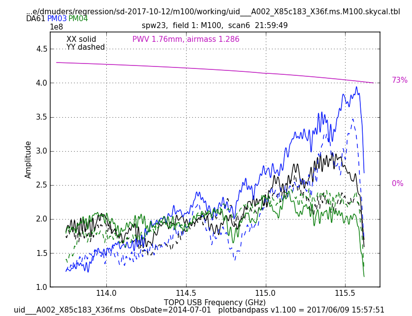
Example of an OFF spectrum. Different antennas are shown in different colours; atmospheric transmission is shown in magenta.
- Parameters:
calmode (str | None) --
Calibration mode. Available options are 'auto' (default), 'ps', 'otf', and 'otfraster'. When 'auto' is set, the task will use preset calibration mode that is determined by inspecting data. 'ps' mode is simple position switching using explicit reference scans. Other two modes, 'otf' and 'otfraster', will generate reference data from scans at the edge of the map. Those modes are intended for OTF observation and the former is defined for generic scanning pattern such as Lissajous, while the latter is specific use for raster scan.
Options:
'auto','ps','otf','otfraster'Default:
None(equivalent to'auto')fraction (float | None) --
Sub-parameter for calmode. Edge marking parameter for 'otf' and 'otfraster' mode. It specifies a number of OFF scans as a fraction of total number of data points.
- Options: String style like '20%', or float value less than 1.0.
For 'otfraster' mode, you can also specify 'auto'.
Default:
None(equivalent to'10%')noff (int | None) --
Sub-parameter for calmode. Edge marking parameter for 'otfraster' mode. It is used to specify a number of OFF scans near edge directly instead to specify it by fractional number by 'fraction'. If it is set, the value will come before setting by 'fraction'.
Options: any positive integer value
Default:
None(equivalent to'')width (float | None) --
Sub-parameter for calmode. Edge marking parameter for 'otf' mode. It specifies pixel width with respect to a median spatial separation between neighboring two data in time. Default will be fine in most cases.
Options: any float value
Default:
None(equivalent to0.5)elongated (bool | None) --
Sub-parameter for calmode. Edge marking parameter for 'otf' mode. Please set True only if observed area is elongated in one direction.
Default:
None(equivalent toFalse)parallel (bool | str | None) --
Execute using CASA HPC functionality, if available.
Options:
'automatic','true','false',True,FalseDefault:
None(equivalent to'automatic')infiles (str | None) --
List of data files. These must be a name of MeasurementSets that are registered to context via hsd_importdata or hsd_restoredata task.
Example:
vis=['X227.ms', 'X228.ms']field (str | None) -- Data selection by field name.
spw (str | None) --
Data selection by spw.
Example:
'3,4'(generate caltable for spw 3 and 4),['0','2'](spw 0 for first data, 2 for second)Default:
None(process all science spws)scan (str | None) --
Data selection by scan number. (default all scans)
Example:
'22,23'(use scan 22 and 23 for calibration),['22','24'](scan 22 for first data, 24 for second)Default: None (process all scans)
- Return type:
ResultsList[SDSkyCalResults]
Notes
QA scoring:
QA = 1.0 if the elevation difference between ON and OFF is <= 3 degrees.
QA = 0.8 if the elevation difference between ON and OFF is > 3 degrees.
Examples
Generate caltables for all data in the context:
>>> hsd_skycal()